TopoNavigator Greece topo maps 4.0.7
Free Version
Publisher Description

Turn your smartphone or tablet into a powerful navigation cartographic tool that will navigate you through inaccessible dirt roads & forgotten footpaths of Greece, with the accuracy of TopoNavigator maps.
New feature: become a beta tester and get early access to new features: https://play.google.com/apps/testing/anadigit.toponavigator.maps
The free version offers:
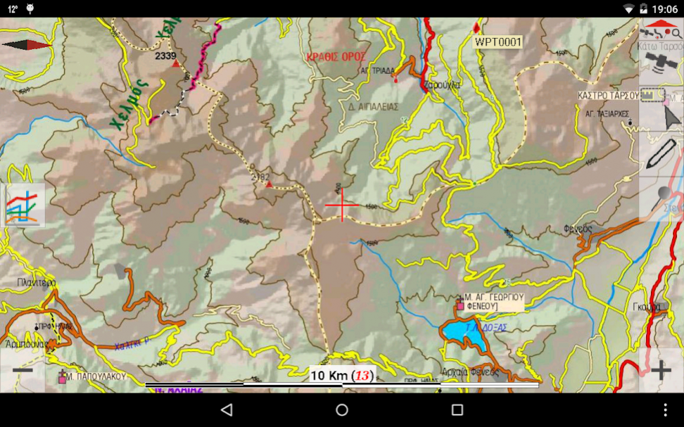
MAPS
• Offline map tiles downloading & caching (including Greek Cadastre aerial photos, OSM, Google & Bing Maps) on internal or external memory (micro SD card)
• Map downloading along 1 or more selected tracks or routes.
• Offline maps management page with the possibility to delete a specific map on a specific level
• Map Rotate, Tilt & Zoom with multitouch gestures
• Greek Geodetic Reference System (GGRS87) coordinates
• Auto or manual map scaling to improve map legibility on high-resolutions screens
• Speed-related map rotation auto-switch based either on compass or GPS heading
• Combined speed-related Auto-Zoom & Auto-Tilt (3D perspective view) with 3 profiles (Travel, Offroad, Extreme 4x4)
• Continuous Speed, Elevation, GPS Accuracy & Slope charts when a GPS is connected
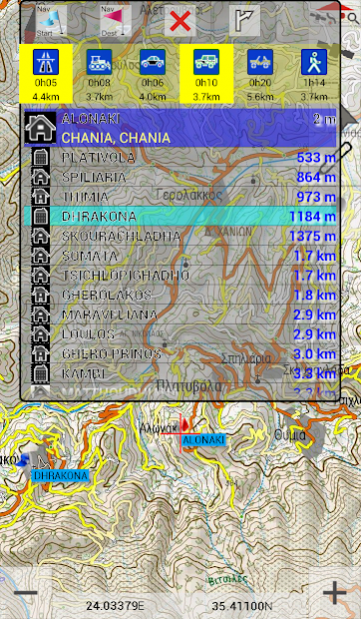
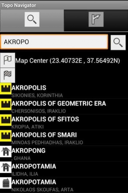
• Offline search for 200000 woldwide cities including 20000 nameplaces, 1900 archaelogical sites & 1400 monasteries in Greece
ROUTING
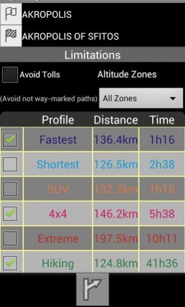
• Online routing for Greece. Options include fastest & shortest route, altitude zone, toll avoidance.
• Start & destination positions can be set either on map, GPS fix, using long press on map, search, coordinates or waypoints. Navigation points can be deleted or modified.
• Unlimited number of routes can be stored for offline use.
DATA
• Digitalization of lines and points with a finger, mouse or stylus.
• Edit lines on your device: click to add a vertex, drag a vertex to move it, long press on a vertex to create waypoint, delete it or split the line.
If 2 lines are selected, use the popup to join the 2 selected lines or delete them.
• Ability to set a solid symbol for lines or choose from 5 color palettes interpreting speed, slope, elevation, pace and accuracy Equal Intervals analysis.
• Unlimited waypoint capture on or off GPS fix. Create, edit or delete waypoint. Move points to GPS fix, to the map center or with drag & drop.
• Unlimited track recording with custom time & distance intervals. Recording line symbol uses a 4-color palette to display GPS accuracy. Track statistics include elevation & speed graphs, duration, min, max & avg speed, min & max elevation, total ascent & descent, 2D & 3D length
• Import & export waypoints & tracks on KML, KMZ & GPX formats.
• After exporting data, you can share the file with Dropbox, Google Drive, email...
• Simplify tracks on save. Options include: no generalization, mild (1m tolerance), moderate (3m) and strong (6m) generalization.
INTERFACE
• 4 languages (english, greek, french & german)
• Direct link to TopoNavigator GPS Info free app that gives satellite info, visualizes pitch & roll values, records NMEA sentences, sends position by SMS or e-mail & offers an advanced Trip Computer
The paid version (TopoNavigator Extreme, 40€ one-time purchase for 3 devices):
• gives access to TopoNavigator maps & offers 6 routing profiles (Fastest, Shortest, SUV, 4x4, Extreme 4x4 and Hiking).
TopoNavigator maps are considered by many the best maps of Greece for any outdoor adventure activity (hiking, 4x4 driving, mountain bike) and includes 20m contour lines.
The maps are available in Greek & Latin characters and cover all regions of Greece: Athens and Attica, Central Greece, Peloponnese (Southern Greece), Epirus, Macedonia & Thrace (Northern Greece), Cyclades, Ionian, Dodecanese & Creta (Kriti) islands.
• Points & lines digitized on screen (off GPS fix) get elevation values from a high accuracy 30m cell Digital Elevation Model (currently DEM is server-based and only covers Greece).
To view TopoNavigator maps visit: http://www.topoguide.gr/index-map.php
About TopoNavigator Greece topo maps
TopoNavigator Greece topo maps is a free app for Android published in the Recreation list of apps, part of Home & Hobby.
The company that develops TopoNavigator Greece topo maps is AnaDigit. The latest version released by its developer is 4.0.7. This app was rated by 1 users of our site and has an average rating of 4.0.
To install TopoNavigator Greece topo maps on your Android device, just click the green Continue To App button above to start the installation process. The app is listed on our website since 2017-02-28 and was downloaded 235 times. We have already checked if the download link is safe, however for your own protection we recommend that you scan the downloaded app with your antivirus. Your antivirus may detect the TopoNavigator Greece topo maps as malware as malware if the download link to anadigit.toponavigator.maps is broken.
How to install TopoNavigator Greece topo maps on your Android device:
- Click on the Continue To App button on our website. This will redirect you to Google Play.
- Once the TopoNavigator Greece topo maps is shown in the Google Play listing of your Android device, you can start its download and installation. Tap on the Install button located below the search bar and to the right of the app icon.
- A pop-up window with the permissions required by TopoNavigator Greece topo maps will be shown. Click on Accept to continue the process.
- TopoNavigator Greece topo maps will be downloaded onto your device, displaying a progress. Once the download completes, the installation will start and you'll get a notification after the installation is finished.
